Finding the Change Along the Route
UpdatesSeptember 29, 2026


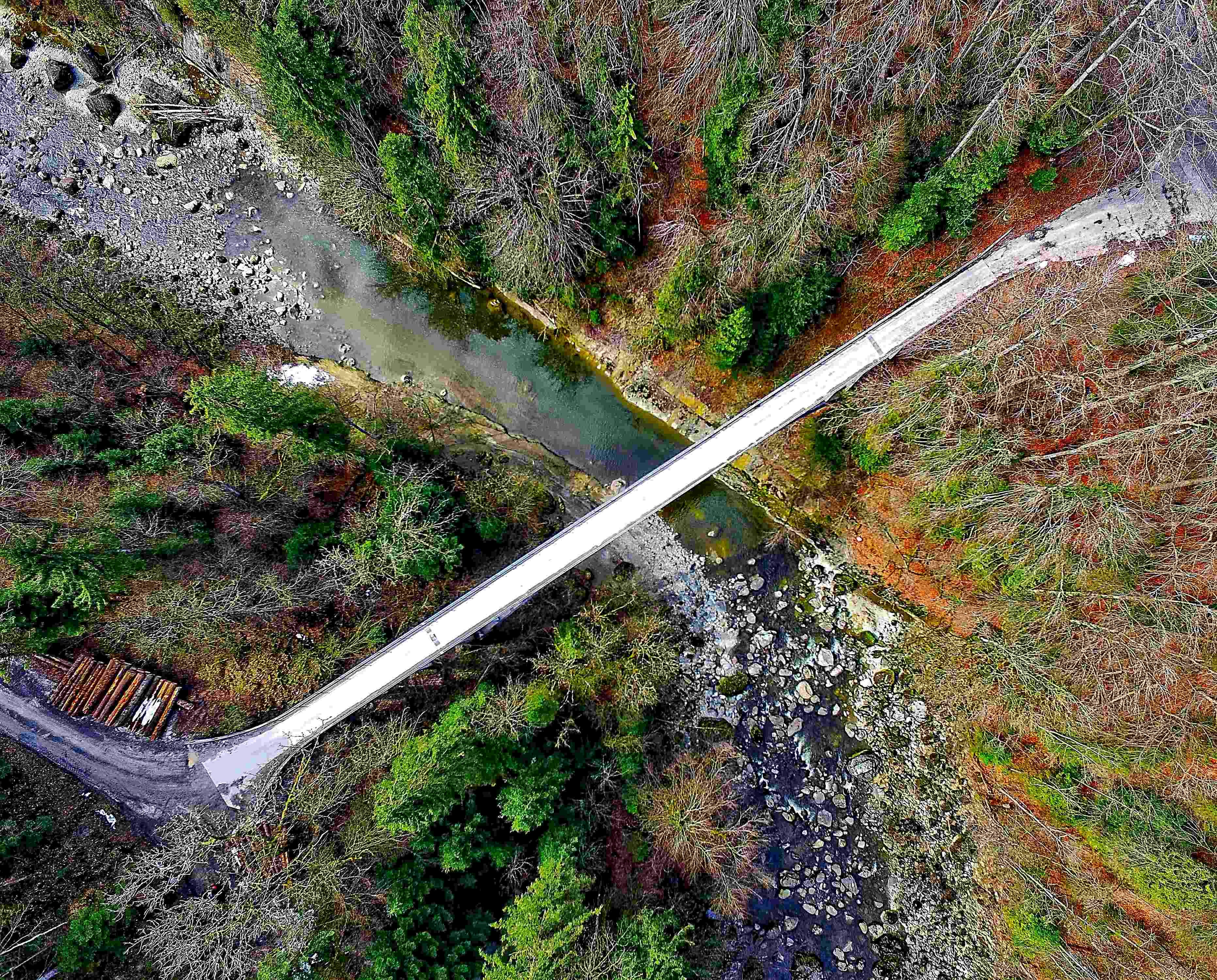
Sensors Can Monitor Infrastructure Continuously, but Covering the Route Itself Still Needs a View From Above
Most miles of a pipeline, powerline, or railway are uneventful, but that doesn’t make watching them simple. A small change can appear almost anywhere along the route, and its significance may not be clear without a record of what came before.
For pipeline operators, that work has long included visual patrols conducted on foot, by vehicle, or by air. Federal pipeline guidance notes that vegetation, weather, and even the angle of sunlight can affect what an aerial patrol is able to see. Covering the distance is only part of the job. The information must also help operators recognize a possible problem and decide what happens next.
What Sensors Can Report
Inspection no longer begins only when a person or aircraft reaches an asset. Across some networks, sensors provide information about specific conditions as they develop.
Pipeline monitoring offers one example. During a 2023 pilot-scale field test, researchers at the Department of Energy’s National Energy Technology Laboratory installed fiber-optic sensors inside and outside a natural-gas pipe. Laser pulses and the light reflected through the fiber produced continuous measurements along the cable, allowing researchers to monitor test conditions that included gas flow, leaks, pressure, and temperature changes.
Power networks apply continuous information differently. Dynamic line ratings use current or forecast environmental conditions to provide a more precise estimate of how much electricity a transmission line can carry. The Federal Energy Regulatory Commission explains that available capacity changes with conditions such as air temperature and wind. This gives operators continuous information that a periodic visual check alone cannot provide, catching a change in conditions between scheduled inspections instead of waiting for the next one.
Railways use a different approach. Wayside detectors draw on thermal sensors, cameras, and more to inspect trains as they pass. Some monitor wheels and bearings, while machine-vision systems collect images of railcars for algorithmic analysis. The Association of American Railroads describes these technologies as complements to the employees who inspect, maintain, and operate equipment across the network.
In both cases, automation focuses attention on a defined signal or condition. Other changes still require someone, or something, to look at the corridor itself.
What Still Has to Be Seen
Vegetation encroachment, nearby construction, erosion, and changes to the surrounding terrain may not produce signals captured by embedded or trackside sensors. Visual patrols remain useful because they show the asset in the context of its surroundings.
Pipeline operators may use patrols to look for these conditions along the right-of-way. PHMSA notes that airplanes or helicopters are often used, while ground patrols may be needed when vegetation or other conditions limit the view from above. The appropriate aircraft and sensors depend on the distance involved and the level of detail required.
Rail inspection has also provided a setting for studying aerial coverage. In 2015, the FAA partnered with BNSF Railway through its UAS Pathfinder Program to explore using drones beyond visual line of sight over railroad rights-of-way, defining the conditions under which similar operations could later be approved.
Covering a corridor is not simply a question of whether an aircraft can travel the distance. Collecting useful imagery and flying the route are related but distinct challenges, and the operation must account for airspace, communications, and the rules governing how the aircraft is flown.
Separating the Flight From the Finding
An aerial inspection serves two distinct tasks. The aircraft follows the route while mission equipment collects information about the infrastructure below. Once that information reaches the ground, it must be reviewed and placed in operational context. Flight automation carries its own technical and regulatory requirements. In September 2026, Merlin announced plans to pursue a civil certification strategy for large aircraft, applying the technical foundation and regulatory experience developed through its earlier certification work to the new program.
Most miles of a pipeline, powerline, or railway may remain ordinary, but the value of inspection lies in identifying the stretch that is not. As sensing and automation change how information is collected, a useful inspection must still provide enough context for the people responsible to understand what changed, determine whether it warrants a closer look, and decide what should happen next.
Cautionary Statement Regarding Forward-Looking Statements
This post contains forward-looking statements within the meaning of the Private Securities Litigation Reform Act of 1995. All statements other than statements of historical fact should be considered forward-looking statements. These forward-looking statements are based on our current expectations and projections about future events and trends. These forward-looking statements are neither promises nor guarantees, but involve known and unknown risks and uncertainties that could cause actual results to differ materially from any future results, performance or achievements expressed or implied by the forward-looking statements, including without limitation the risks, uncertainties, and assumptions as described in our filings with the U.S. Securities and Exchange Commission. Except as required by applicable law, we undertake no obligation to update any of these forward-looking statements for any reason after the date of this post.
Related


Four Decades of Flight Test, One New Frontier: Meet Al Lawless
Update
Aug 20, 2026

Merlin Expands East Coast Presence with New Flight Test Operations at Quonset State Airport
Update
May 01, 2025


A Letter to Shareholders from Matt George, Founder and CEO of Merlin Labs Fellow Shareholders
Investor
Feb 19, 2026